Flat Top Hill Trails
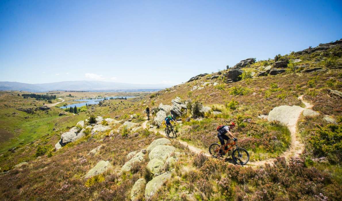
A mix of technical single tracks options for Intermediate and Advanced riders around the conservation area. Spectacular views into the Roxburgh Gorge.
The trails at Flat Top Hill have been built by volunteers from the local club, Mountainbikers of Alexandra (MOA). A mix of options allow for a 10km loop that returns to Butchers Dam, or a challenging descent into the Roxburgh Gorge.
Access is from the carpark at Butchers Dam, 5.5km south from Alexandra on SH8. Alternatively, the start of Sphinx Rock track is 9km south of Alexandra on the Roxburgh Gorge Trail.
The car-park is on private land (no camping) and the DoC toilet is by the track on the far side of the dam.
- Please don’t use Lye Bow Road for access, there is no parking and re-joining the highway is extremely dangerous.
- This is a dual use area, so please treat other users with due respect.
- All the trails can be ridden in either direction, so watch out for oncoming riders.
- The bike trails are marked with blue warratahs and the walking tracks with orange. Riding is allowed on the walking tracks, but that is not recommended.
- Please do not take any short cuts. These cause erosion and can damage rare native plants. The agreement between MOA and the Department of Conservation for the use of the area depends on riders keeping to the tracks.
Purple Haze | 4.5km, Grade 3 or Blue (Intermediate)
This is a dual direction trail and is the best route for climbing to the top of the hill. Starting from the Butchers Dam carpark, cross the dam and head south. A poled track starts climbing behind the trees at Lye Bow. Cross the haul road and follow the blue/orange markers up the hill, a few technical corners and steeper sections.
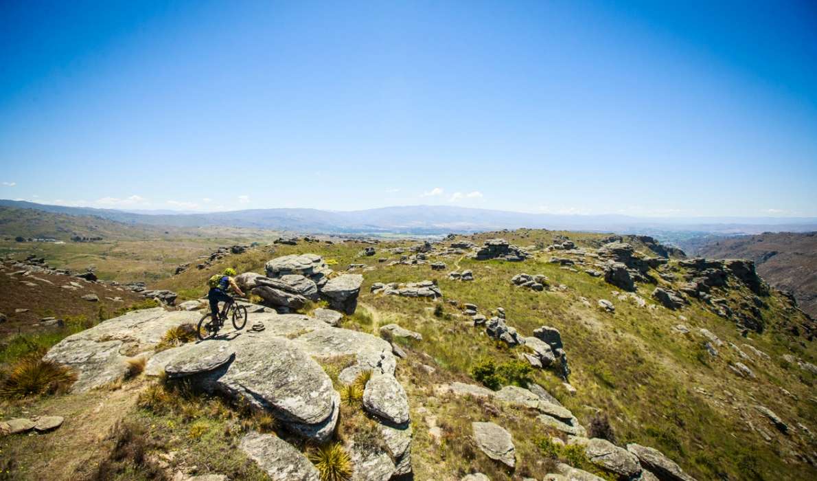
Sphinx Rock Trail | 6km, Grade 3 or Blue (Intermediate)
Climbs from the Roxburgh Gorge over 6km and 400m of climb to the summit of Flat Top Hill. Starts near the 9km mark on the Roxburgh Gorge Trail. Don’t try the orange poled Haul Road East, at the 8km mark, which does the same climb over 2km.
The Sphinx Trail can also be accessed from the top of Purple Haze.
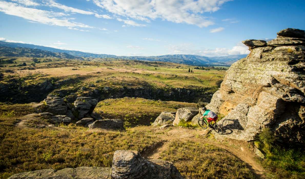
Black and Blue Trail | Grade 3 or Blue (Intermediate)
From the top of Purple Haze, follow the ridgeline to the Northern end of the Conservation area. The trail follows section of single and double track and is marked by blue markers. Look out for the bike friendly options that bypass some of the steeper sections of the old walking track. A short descent marked from the Thymeless Trail - an intermediate 'Blue' descent, with optional 'Black' lines for this looking to challenge themselves with step-downs and rock gaps. (Scouting is recommended). This is a dual direction trail. Continue from the bottom of the trail back to the dam.
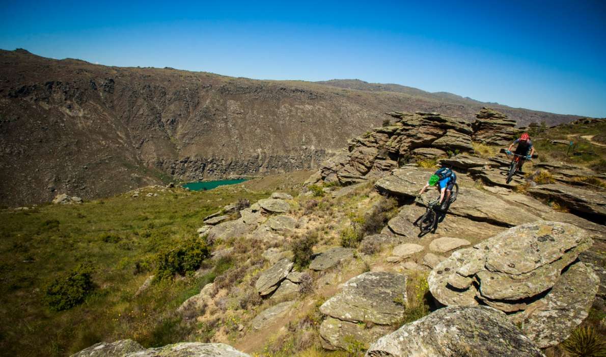
Rock of Doom Trail | 1.5km, Grade 6 or 'Double Black' (Advanced)
Turn off the Purple Haze Trail and descend to the Clutha River below. This trail has been graded 'Double Black' and is not for the faint-hearted. The trail is extremely steep with big rock features, drops and exposed riding. Definitely not for everyone.
From the bottom of the Rock of Doom trail return to Alexandra via the Roxburgh Gorge Trail.
 How to find Flat Top Hill Trails
Distance
1 km
Address:
Flat Top Hill Conservation Area
Alexandra
Email:
mtbofalex@gmail.com
Website:
http://www.mtbofalex.co.nz